June 3rd
1mi S of Sierra Canyon Trail Junction(10.1)-Tunnel Creek Rd(32.4)
Campsite Elevation: 7766ft
22.3mi+1.2mi overlook trail=23.5mi
This elevation chart is a screenshot from Guthook’s TRT Guide App.

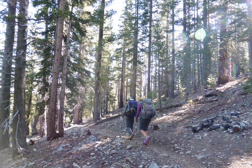
The birds were chirping loudly and I woke up a bit before my 5:45am alarm. I keep a little watch near my head at night and rarely hear the alarm, but usually wake up before it goes off anyway. I have had it set for that time since the beginning of the Hayduke. When I started to get ready, I noticed that it was light out, but not as bright as I thought it should be. Then it hit me…did I ever change that watch since returning to the west coast time zone? I turned on my phone. It wasn’t even 5am, ugh! I totally would have gotten ready and not noticed a thing if I hadn’t looked. Now I was awake and had to use the bathroom. I was able to settle back in after climbing out of my bag to dig a hole and got a bit more sleep until it was really 6am and we were hiking by 6:45am. We had more gradual climbs and descents today and that made for really nice hiking. We started out in the woods and I know it doesn’t look like much, but it felt like home and I was pretty darn happy.
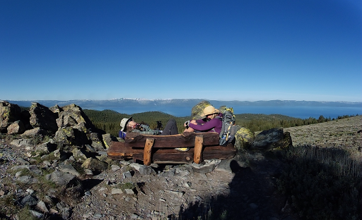
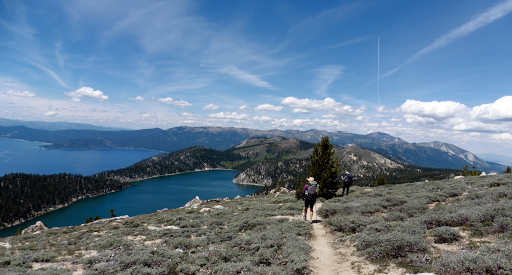
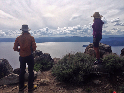
Then we got on a nice traverse with an extended view of the lake near South Camp Peak. There was even a spot with a nice bench and Why Not and Rockin’ thought it would be a great spot to envision a nap. We took our time to take in the view and take photos. We planned this trip to average 22mi days, which is somewhat relaxed for us. It should be just the right balance for us to take it in and enjoy the hike.

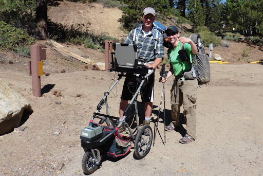
Then we hiked down to Spooner Summit Picnic Area. At the trailhead, I saw a guy pushing a jogging stroller, or at least that’s what I thought it was. As I got closer, I realized it was something much cooler. It was a jogging stroller with a laptop on it! It turns out, he worked with a company that does many services for people with physical disabilities, including assessing the accessibility of trails. His contraption was the official width of a wheelchair and it had sensors on it that measured things like the grade, width, and terrain. It is then documented and listed on a website for the public and often used for people to assess if it is a trail they can attempt given personal abilities and disabilities. I couldn’t resist getting a photo of the laptop on the trail, ha!
After a break at the trailhead, we headed up again and stopped at a viewpoint for lunch. Then we had a gradual extended uphill that had a great extended view as we hiked along a ridge going along North Canyon with views of Lake Tahoe and Marlette Lake. The clouds built and wind picked up as the day went on. This is my favorite view so far.
We then had some more gradual downhill to our one on trail water source for the day, a water pump at Marlette Peak Campground. With the awesome weather and gradual hiking, we all had plenty of water and chose to skip the off trail source at Spooner. It is 13mi between sources and another dry camp tonight, which has proven to be pretty simple in this nice weather. We all grabbed 3L for the 13mi and dry camping.
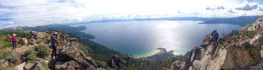
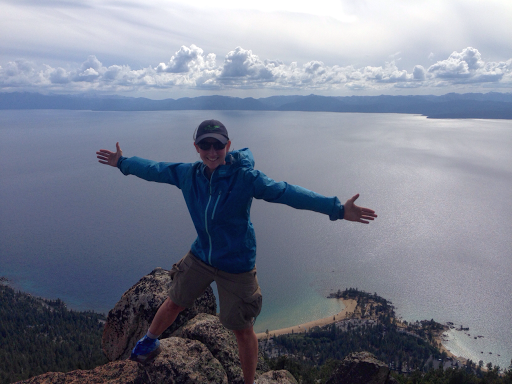
All of us are adjusting to hiking again and experiencing the regular aches and pains. I still feel quite achy like I have the flu and started my period today, so it totally makes sense, dang. Just hoping my body can bounce back quick so the physical part of this can be more enjoyable. I’m most surprised to have pain from wearing a pack (shoulders and love handles very sensitive) as if I haven’t had one on in forever. This is cruising terrain, I don’t have the regular spring in my muscles I usually do…and the feet feel like they have been road walking. Looking forward to when this all works itself out. We were told about a great side trail that led to a viewpoint of Sand Harbor Overlook. It was 4pm and we almost chose to pass on the extra 1.2mi out and back, but then decided to leave the packs and go for it. It was well worth it! I even got to Skype my sister and nephews to see the view. The color doesn’t come out in photos, but the water was a beautiful blue! It was windy and getting cooler, but we stayed up there awhile taking lots of photos. Thanks to Reno Dave for the tip! Sure glad I didn’t miss this one!
After we returned to the trail, it was a nice downhill for a few miles until we reached a point that we knew there was a long ridge walk with little level ground for camping. It put us right at our goal of at least 22mi/day (not counting the 1.2mi overlook trail) and we were done at 6:15pm. The weather tomorrow has 80% chance of rain or thunderstorms in the afternoon. It doesn’t look like we’re going to dodge this one and just hope it is quick and doesn’t last all day. It is gusty and feels colder than last night. We are going to get up a bit earlier to get more miles in before the rain tomorrow. We are also on a very popular bike section of the trail and want to get through the next 8mi early if we can to hopefully avoid many bikes. We have only seen a few bikers and day hikers. We saw one pair of backpackers this morning. This is a busy trail with hikers, bikers, and horses, so we are relieved to have seen few people. We have had most of the trail to ourselves and know that isn’t always the case. I’m sure we’ll see more traffic over the weekend if the weather clears. We found a good camp spot among some trees to break the wind a bit. Bracing for cold rain tomorrow…