July 18th
Lac du Milieu-Refugio de la Renclusa
Campsite Elevation: 7021ft/2140m
*No mileage available. The guidebook lists distances on the route by time rather than miles.
I slept ok last night having just a couple times when the wind kicked up and woke me up. Today is the toughest day of the whole route. I’ll give fair warning to people that I’ve been doing about 1.5 days of the book’s recommended itinerary each day, so anyone gauging pacing, know this is more than the book requires for a day. Overall, the book is on Day 22 while I’m personally on Day 17. It’s a combination of being slightly faster than book time and putting in more hours than the ~7-8hrs of hiking the guidebook tends to average a day.
Up to Col des Gourgs-Blancs.
I wasn’t quite sure what to expect, other than alpine conditions with steep ascents/descents, lots of rock, and some snow fields. I was a little anxious, but then figured it couldn’t be as grueling or sketchy as the Sierra High Route I did last year. Why Not was with me on that one, and I think we may agree that it set quite a bar that neither of us need to meet again. However, it is nice to have done something like that just to know you can, and it makes everything else seem simpler. The SHR was basically three weeks of today on steroids.
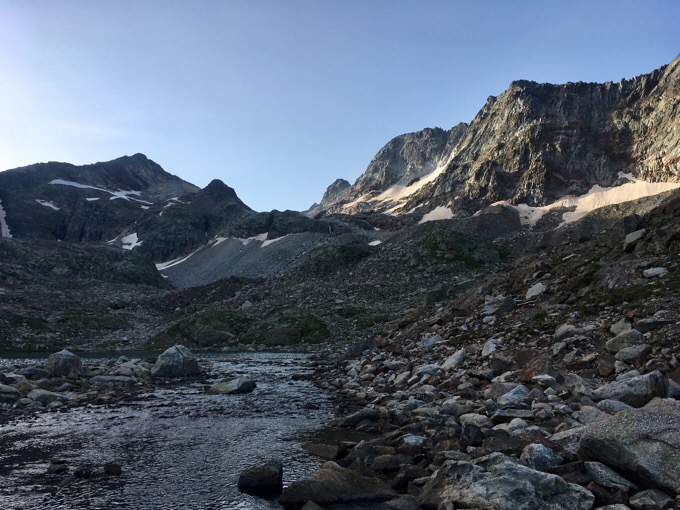
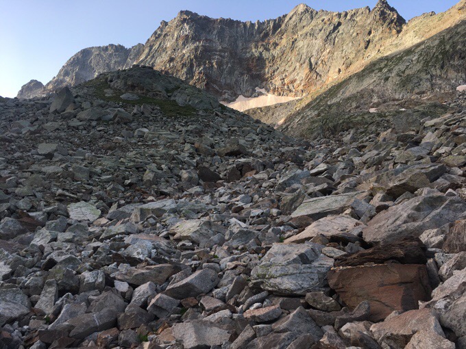
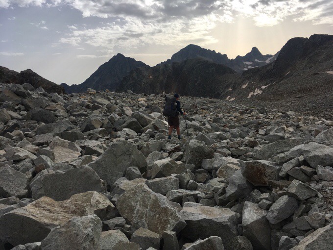
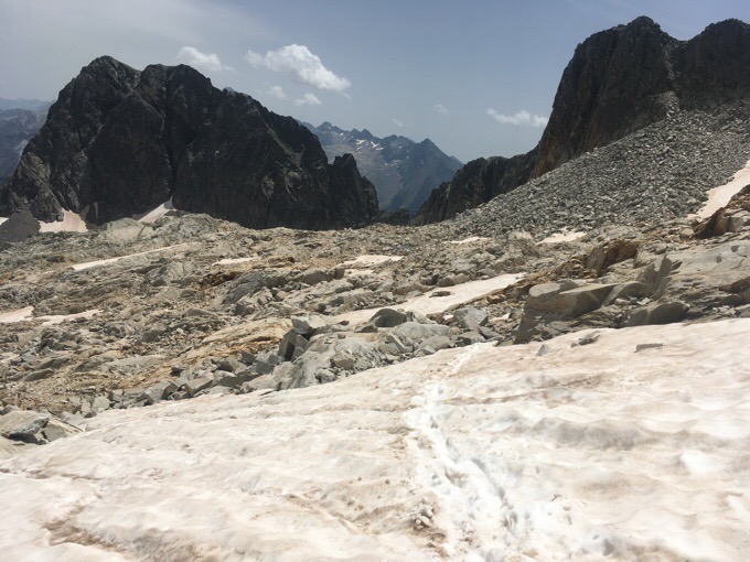
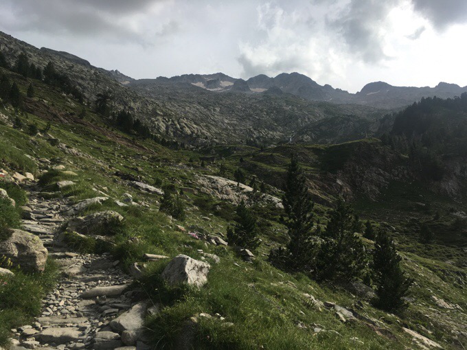
There was no warmup today as I’d already hiked up the easier stuff yesterday. It was right up the scree. The steepness wasn’t really an issue as much as the rocks for me today. I am fine with it in sections, but when I’m on rocks most of the day, like today, my mind and body gets tired. Particularly my bad ankle, the one that had major surgery over a decade ago to repair a severed ligament. It is forever wobbly and unstable, so unstable footing is especially a challenge for me. I am aware with every step of my life to position it so my toe points out, and it doesn’t roll. Yes, I’m sure that’s great for my knee and hip, but they haven’t complained yet… The problem with scree is that there’s no knowing if what I’ll be stepping on will be stable. Often times with scree, rocks shift or wobble randomly when you apply pressure. When that happens in the wrong direction, my bad ankle goes out on me and rolls. I’ve gotten good at using my polls to compensate so I don’t fall, but there was a lot of that today, and it got both painful and anxiety provoking wondering if each step would hold. Especially because there was a lot of downhill on the rocks, which are most worrisome as I need put my full weight on them not knowing how stable they will be. I should have worn my brace, but I was hard headed and I’ll be wearing it tomorrow as the ankle is sore and weak after so much of it today.
Back to the first climb up to Col des Gourgs-Blancs. It was fun in the morning air and with fresh legs. I saw three others as I went up.
Looking back. I camped by that lake.
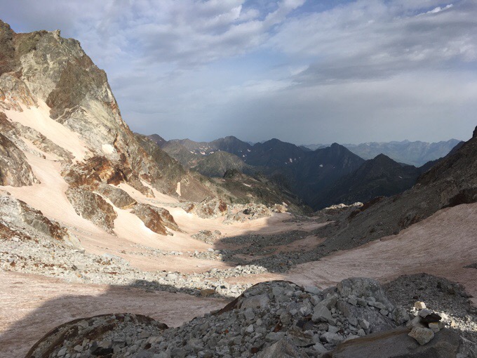
Then came the first real need for microspikes on Col du Pluviomètre. It looks steeper than it really was. The snow was a good consistency to feel comfortable gripping with the micros on. There were four people coming down with crampons on (much bigger spikes) as I approached. I think going down would have been more intimidating.
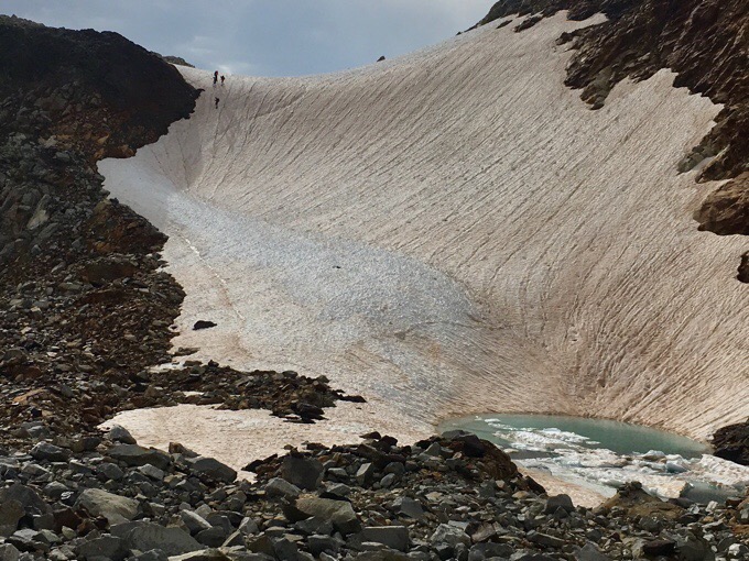
Notice people coming down.
I went down to the right instead of left.
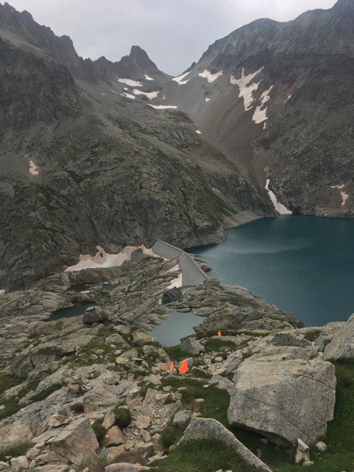
See the refuge at the bottom by the dam.
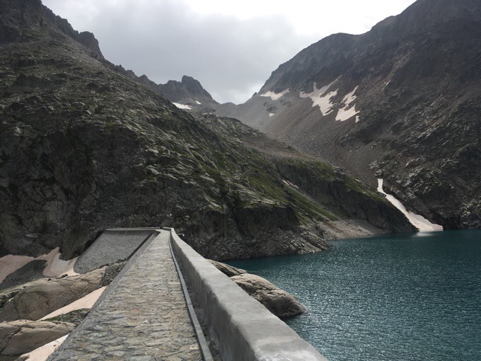
Crossing the dam.
Looking back after climbing up.
I headed down below where the people are standing in the center.
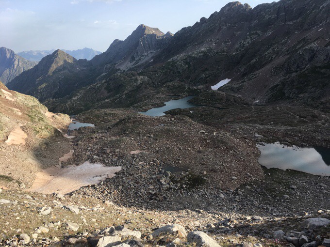
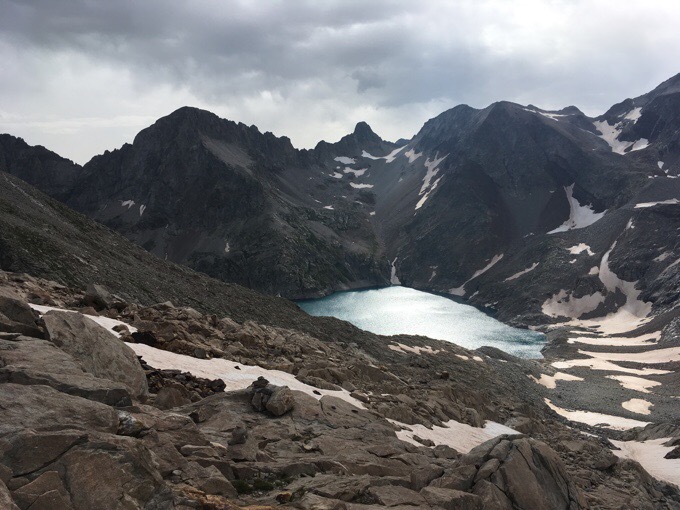
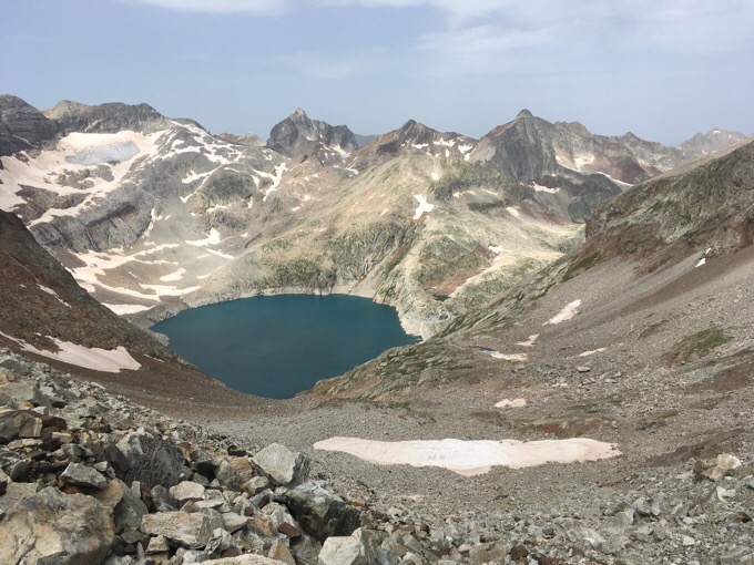
Eyeing the traverse above Lago de Literole.
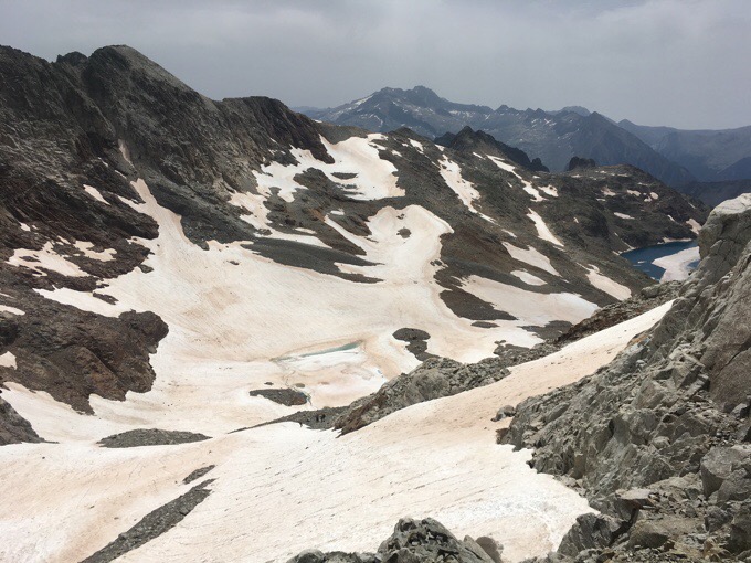
Snow ends, “chaotic granite wilderness” begins.

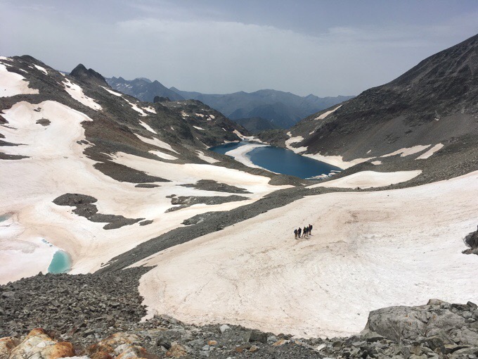
Down to the Valle de Remune.
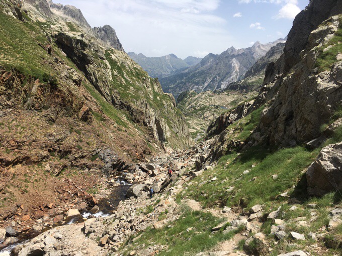
I celebrated actual trail at the bottom of the valley, but even that was short lived as there was still another hour or more of uneven grassy rocky terrain along the stream.
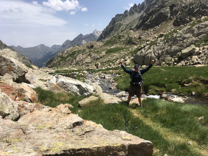

I hit an area where tourists stay and got service. I called Paul who will be hosting me and told him I’d made it far enough to make it to him tomorrow night. That’s been my hope in doing these longer days. I’ll make it tomorrow night and then get a full zero the next day, yay! I also took time to upload the blog from the last two days. It turned out that Why Not and Jim were in Parzan for the night, so I got to talk to Why Not and give her the good news that this section is not a steep or grueling as what we did on the Sierra High Route last summer.
By the time I finished all that, it was already 5pm. My planned endpoint of a refuge, which is the end of the guidebook description for this day, was still 2hrs away. I decided I’d walk the Valle de Esera, grab some water, and then camp earlier than planned. Not earlier in time, but in location. As I walked, I found myself surprisingly energized with a second wind. I was on clear smooth trail and my body was loving it!
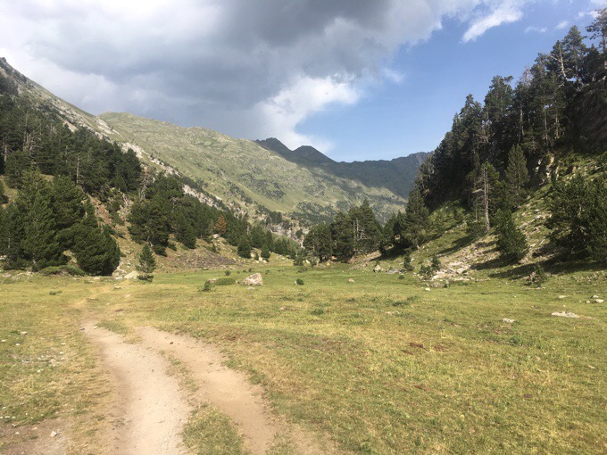
Plus, the valley was a cow pasture, the water wasn’t appealing, and there were no camping signs clearly posted in the area I had hoped to stop. I saw a sign that I was only 50mins away from the refuge. Since I felt good, and it might rain tomorrow, I figured I’d make it a longer day and hike while the weather and my body was good. Plus, that gave me time to listen to an episode of the Harry Potter podcast, which I couldn’t do on the more technical terrain today. A nice end to the day.
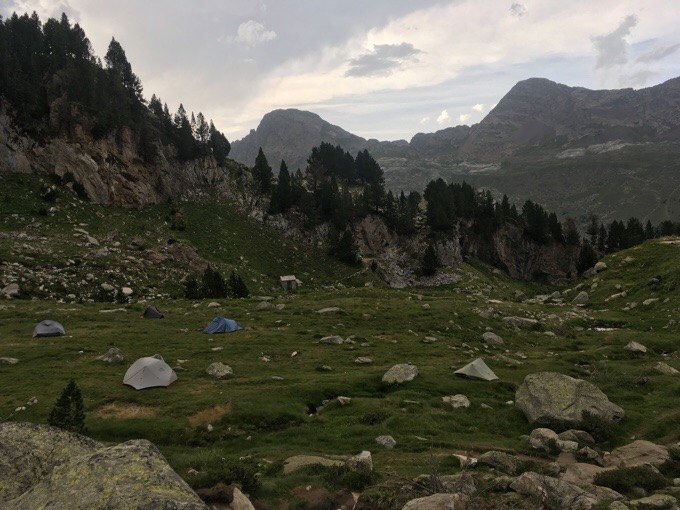
Refugio de la Renclusa on the plateau in the center.
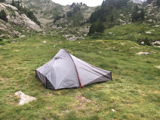
The tent I’ve seen the most out here is this one. It is a Quickhiker Ultralight. Quite popular out here, but I don’t know the specs on it.
As I looked over the route for tomorrow, I notice the first sentence says to backtrack BACK DOWN THE TRAIL. WTF!? I looked at the maps and GPS. This refuge, though described as part of the route, is a .6mi/1km out and back. 40mins up and like 30 down tomorrow. I just walked UPHILL and extra kilometer to camp in an open field with a bunch of other people! Had it been midday, I would have totally blindly made the walk here, then turned the page to read the next chapter, and realized I needed to turn right around and go back down the switchbacks I unnecessarily went up. There is no warning of this at all, so heads up to future hikers. Not a big deal in the whole picture, but at the end of my long day, it was not fun note to end on. Tomorrow is described as a “magnificent stage” so I’m excited about that as I finish up the first half of the route tomorrow and will be taking a zero to celebrate the next day.


Wow – tough day and a little disappointing in the end to find you have to back track!! It does look pretty there and sounds like tomorrow will be a great day before your zero. Good luck and hope your ankle holds up!!
Looks a lot like the Trinity Alps… and a lot of fun! : ) Enjoy yourself!
I’d say it slots somewhere in between the Trinities and the Sierra. I just day hiked to Seven Lakes basin this past Saturday and did some exploring. Very beautiful but about 12 people had managed to drive in somehow and were wooping it up and firing guns. Turned 8 out of 10 views into a 4 out of 10 hike. I’m planning to check out Big, Little, and Wee Bear Lakes this weekend or next depending on when I can find the time.
That kind of stuff I’ve thankfully seen none of out here at all.
As soon as you started in about scree, I knew there was no podcast for that section.. Glad you got some easier parts toward the end.
I KNOW Why Not was thrilled to hear your report with comparison to the SHR, which I remember from both blogs as being exhausting (lol.. even sitting here at home!) but quite the accomplishment. Rockin’ seems to thrive on that stuff, but it sounds daunting for sure.. Especially hiking solo.
Hope the Zero is going well!!
Loving the zero and loaded up plenty to listen to the rest of the way:)
Thank you Wired for being so consistent with your blog, despite limited wifi at times. I know it must take a lot of dedication to keep up. Do you think the key is just making it a mandatory part of your daily routine? I notice, understandably I guess, that a lot of people start off strong with close to daily blog posts, but then fade away as they get halfway through their thru-hike or more.
I plan to blog my PCT hike, whenever that happens, and would love to know how you manage to stay so consistent with the updates.
Oh man, it SUCKS! I have been giving people advice to instablog summaries of slideshows on Instagram instead of doing an actual blog. Those of us that have done this consistently for years have a love/hate relationship with it. It gives us a lot and is personally fulfilling, but takes a lot. For me, I have many things in my favor. My wiredness allows me to hike faster and I also need less rest than most, so I can stay up late blogging while others are sleeping. I also socialize less, so I can take the time away from the other hikers that’s required to hike. It’s a commitment and does for sure take you away from the social aspect of the trail and that’s why most quit. They’d understandably rather just be present than feeling like they have homework everyday. For me, the main drive is that the blog makes me feel like I deserve this awesome life. If it was just me and I shared it with no one, it wouldn’t be as personally fulfilling. It would feel too selfish. Not that others that don’t blog are selfish, but I have much “guilt” that I’m not using my free time to better society by volunteering or doing something more. The blog for me is a balance of making the hiking feel like it has a higher purpose because it’s not just for me and positively impacts so many. Everyone comes along with me and it empowers so many to do it themselves. The sense of purpose is big for me, but know that there’s a major sacrifice in that I’m not as part of the social aspect of hiking and can’t always just be present because there are responsibilities. I’m definitely missing out on a part of life there, but it’s a sacrifice and I try to balance it. Not everyone needs to do it in such detail as me, and everyone finds their balance with it. I don’t love doing each night when I’m tired, but I have them printed at home and have that for the rest of my life and love them!
Thanks for the thorough response. I follow Griggs on Instagram, but honestly, it’s a lot less informative and a bit confusing because there’s no flow to it. 6-10 photos without a clear sense of what you are looking at. Your daily posts are probably a bit more in depth (thank you!) than I would attempt, but I think I will still try to stay the course when the time comes.
Yeah, it’s a compormise.
Much as I came to score Griggs, he is lost to me on Instagram.. I did sign up just for him, but it just turned out that I won’t keep checking for posts.
Your blog is the best, even down to bring able to follow a post for come without making a comment each and every time, and without having to deal with a confirm for each follow.
I certainly appreciate your sacrifice, and the people who comment. I love the back and forth, where you provide fresh Intel and often are rewarded with information from those who have walked where you are walking, or who are in place to meet up and help out.
I know you are touching my life and so many others, so consider in my case you are adding a dimension to my life that helps me to do the volunteer work!
The Quickhiker 2 weighs 2kg and costs only 120e.
Good to know.
What’s it with you “I should have worn my brace, but I was hard headed” and chocolate pudding?! Just joking. Sometimes we’ve a few things to learn by experience, even if we have to keep doing it over and over, apparently. I think we are all the same, just in different ways. I hope you are having fun!!!
Go!Wired!Go!
I wore the brace the next day, and can’t seem to win. It irritates my skin and tendons at times and is a trade off for one pain for another. IDK.
You’ve probably tried this, but how about a very thin liner sock, then the brace? Sounds hot but maybe it would offset the irritation? Pain sucks….
Ditto to JerryW, your blog is amazing, no doubt about it. Nothing like this comes for free, except to all of us whom are subscribed to it. Thanks are never enough.
You’re so welcome! I don’t think the liner would help what is happening. It has some stitching that just presses wrong on my foot. It’s the best I’ve found and only use it when I have to. I have sensitive feet and the slightest difference really makes the tendons react if I don’t have it just right.
I had a custom CTI brace after I took out my left ACL.
I did wear it over leggings and also had a neoprene sleeve. It did keep the top and bottom of that leg in line which allowed me to walk .
But as time went on (and I lost weight) it would hit a nerve, or slip and it was horrible.
My ACL replacement surgery freed me of that.
I can TOTALLY get your dilemma and how something that seems all positive like a brace creates problems of its own.
And I know how difficult it is to get it just right.?
And then in your case, you are out there using your legs to the max!
Yep, exactly.
I have an inkling of what you are dealing with. No surgery, but constantly spraining my ankles from junior high on while playing sports. Now, I could wear an ankle brace while hiking, but evidently, I prefer rolling my ankle 3 to 5 times per day, especially when off trail. I also want to thank you again for your dedication to blogging.
Erin, you are still going like an express train, it is so impressive, but please don’t forget to chill sometimes too!
I agree Ton (not tom) Joosten’s book is the best, but with 500 miles to cover in a small book he has to be a bit terse at times (and English is his second language) and I went wrong a couple of times because I misunderstood what he meant. Didn’t know about the new edition, I will look forward to it.
Your ability to do all this and produce a daily top class blog as well is just amazing. It’s like being back there. ..
Oh you’re right, I need to fix that! So glad you’re enjoying it! The zero today was decadent:)
Also, I just linked Tom’s blog, which I should have done originally. He’s on the route not far behind me. https://tommmartens.wordpress.com
A “perfectly” gorgeous day! Well done. All that scree talk reminds me of my recent hikes on Hood.