
Sponsors


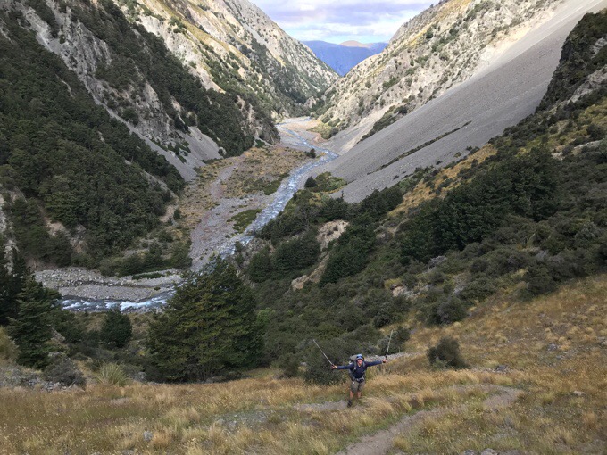
Day 89: The Rangitata Dead End
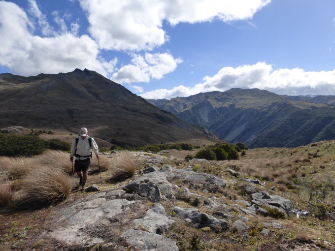
January 31st Castleridge Station(1422.7)-Crooked Spur Hut(1444.1) Mileage: 17.7mi/28.4km Campsite Elevation: 3363ft/1250m I slept great last night. Man, I love sleeping in my tent. We made a great choice of camping in the shelter of the trees too. I woke refreshed at...
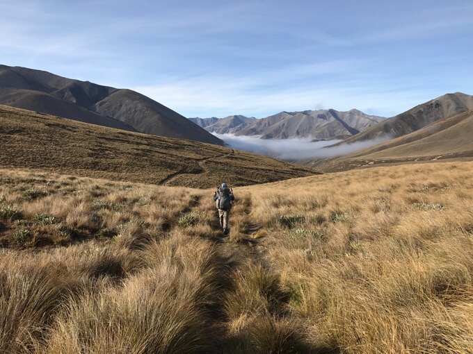
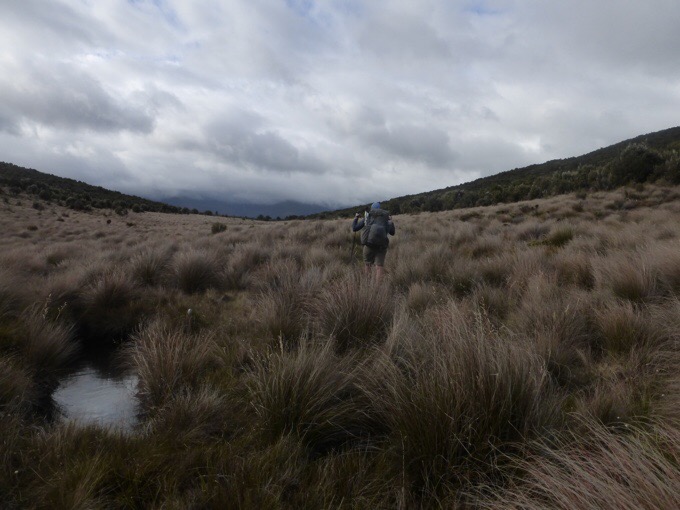
Day 88: The Day The Tussock Swallowed Me
January 30th Double Hill Run Road(1395.6)-Castleridge Station(1422.7) Mileage: 27.1mi/43.6km Campsite Elevation: 2580ft/869m I stayed up way too late last night. I should have gotten to bed earlier, but I wanted to get certain things done online before I headed out...
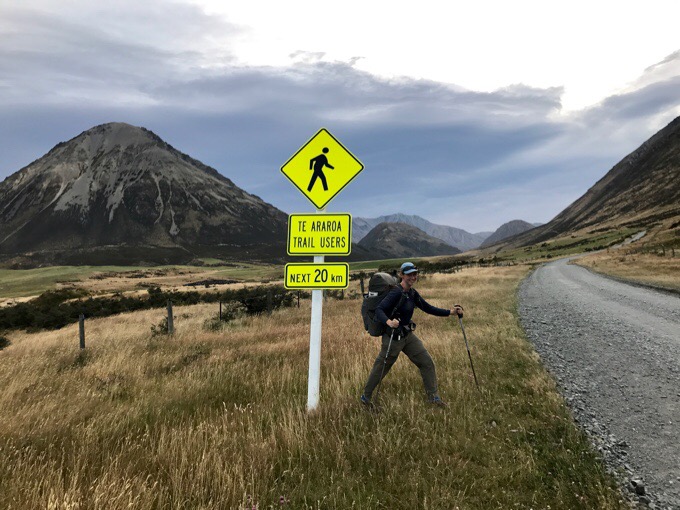
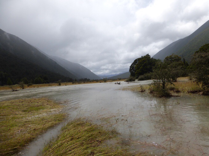
Day 87: The Rakaia Dead End
January 29th Trust Power Campsite(1377.2)-Lake Coleridge/Methven(1395) Mileage: 17.8mi/28.6km We got going early for the 18mi/29km mostly dirt road walk to Lake Coleridge. Yes, we were just in Arthur's Pass and now we are reaching another town. This situation is a bit...
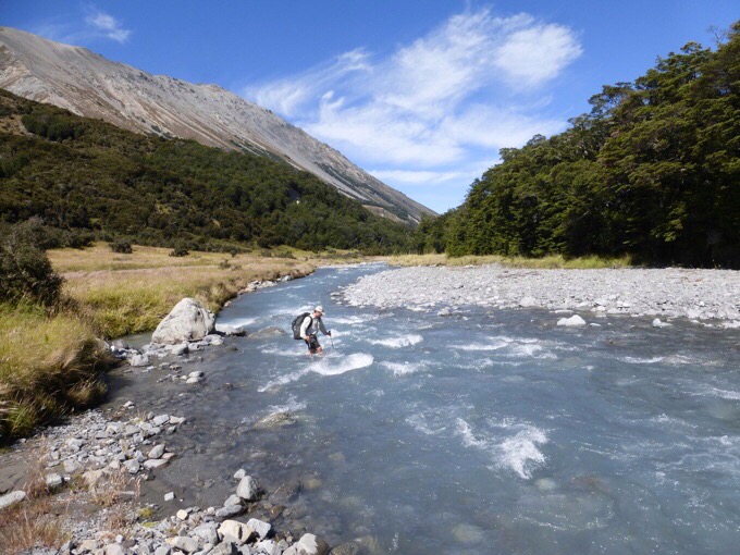
Day 86: The Other End Of The Spectrum
January 28th Lagoon Saddle A Frame Hut(1360)-True Power Campsite(1377.2) Mileage: 17.2mi/27.7km Campsite Elevation: 1683ft/513m It was great to get caught up on some sleep last night. Temps seemed to drop pretty low and it was the first night all trail that I was...
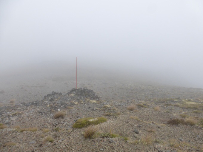
Day 85: I See The Sun!
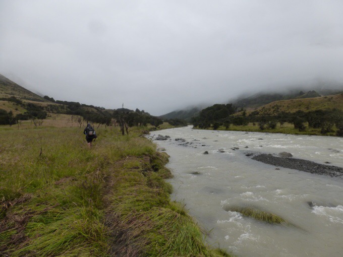
January 27th Arthur's Pass(1347)-Lagoon Saddle A Frame Hut(1360) Mileage: 13.4mi/21.6km Campsite Elevation: 3770ft/1149m *Walked official road walk alternate from Arthur's Pass for when the rivers are too high. The rain from yesterday continued...
Day 84: Rain, Rain, Go Away
January 26th Locke Stream Hut(1322)-Arthur's Pass(1347)* Mileage: 26mi/41.8km *Had to do the official 20km road walk alternate because the Deception River was too high to go up Deception Valley. Welp, today was yet another day of rain. A full day of rain. Like...
Day 83: Fairly Uneventful And Welcomed
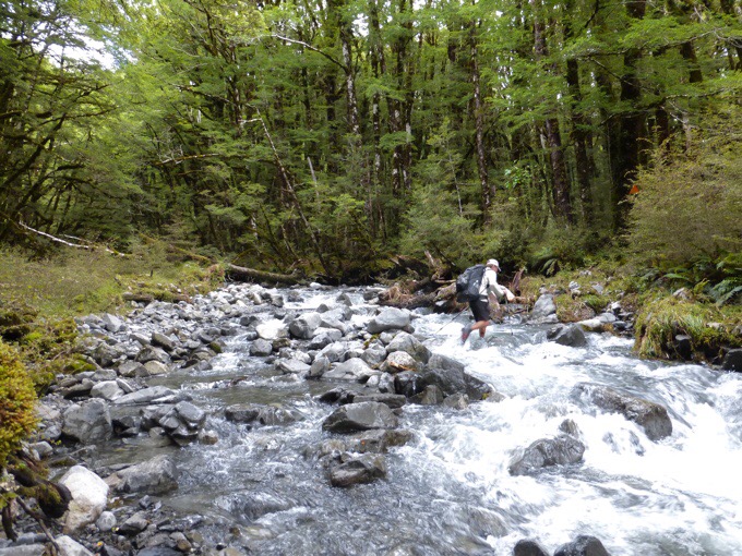
January 25th Hurunui Hut(1307.1)-Locke Stream Hut(1322) Mileage: 14.9mi/24km Campsite Elevation: 1676ft/511m It rained on and off through the night. I could hear the wind and rain, and was again so thankful to be in a hut! We'd agreed to sleep in knowing it would rain...
Day 82: Finally, A Day To Walk
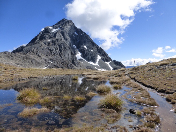
January 24th Boyle Village/Hanmer Springs(1280.4)-Hurunui Hut(1307.1) Mileage: 26.7mi/43km Campsite Elevation: 2073ft/632m We were up early to catch the shuttle back to trail. We could have hitched the 34mi/55km back, but it may have taken a couple hours or more to do...
Day 81: Zero In Hanmer Springs
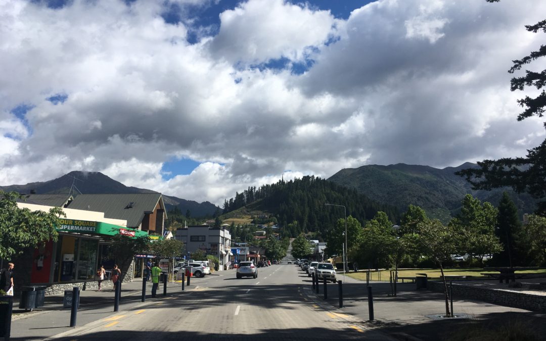
January 23rd We did the regular zero day town chores and catching up on personal things. I have to say Hanmer Springs is my favorite town so far. Beautiful with mountains all around it. It is known for the man made pools made from natural hot springs, but neither of...
Day 80: The Long Soggy Slog Out
January 22nd Ada River(1257.4)-Boyle Village/Hanmer Springs(1280.4) Mileage: 23mi/37km (+5km side trail)=42km The rain did fall overnight, but not as much as predicted. There were periods of heavy rain, but thankfully when we got up, the rain had stopped. I was...
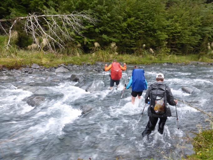
Day 79: Racing Rain & Rivers
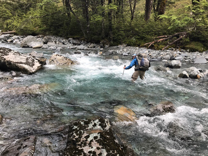
January 21st Blue Lake Hut(1236.7)-Ada River(1257.4) Mileage: 20.7mi/33.3km (+2km side trail)=21.9mi/35.3km Campsite Elevation: 2648ft/807m The alarm was set for 4:45am with the hopes of leaving by 5:30am. It was darker than we expected, so Griggs and I waited...
Day 78: Clear Skies, Grand Views
January 20th John Tait Hut(1223.3)-Blue Lake Hut(1236.7) Mileage: 13.4mi/21.6km Campsite Elevation: 3933ft/1199m It was a great night of sleep with amazingly no snorers or rustlers out of 12 people. I was awake early at 5am and stepped outside to use the bathroom,...
Day 77: Into The Flood
January 19th St Arnaud(1208.6)-John Tait Hut(1223.3) Mileage: 14.7mi/23.7km Campsite Elevation: 2707ft/825m Note: I didn't have service to post this last leg, so I'm just now catching up after four days. Apparently, there was a troll, which I've mentioned before...
Day 76: St Arnaud Before The RAIN
January 18th Porters Creek Hut(1191.1)-St Arnaud(1208.6) Mileage: 17.5mi/28.2km Today was a town day! Even more exciting, it was a town day when heavy rain is on the way. It doesn't get much better than that for motivation to get up and out in the morning. It was a...
Day 75: My Turn In The Fog
January 17th Mid Wairoa Hut(1176.1)-Porters Creek Hut(1191.1) Mileage: 15mi/24.1km Campsite Elevation: 2935ft/895m I slept really well last night in my tent with the nearby stream. So well that I was wide awake at 4:30am. It's amazing to me how refreshed I can be...