
Sponsors


Day 1: Let The Games Begin!
July 5th U.S./Canada Border(0)-Waterton(3.9mi/6.3km) Daily Distance: 3.9mi/6.3km **Note: For many of you, this may be your first time reading one of my trail journals. I usually do more background and prep posts about trails before the hike, but I ran out of time for...
Day 5: Mission "Shakedown Hike" Complete
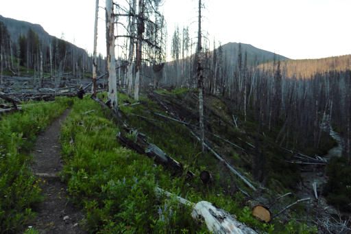
July 4thBowl Creek (68.1)-W Fork Teton River TH(80.8)12.7miWe knew we were camped in an area animals might walk through last night. Heck, most all this deep wilderness looks like prime bear, deer, and elk territory. It was our closeness to a creek and fire ring...
Day 4: Classic CDT Whoops!
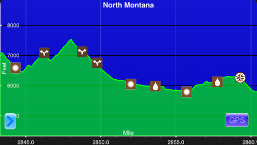
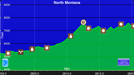
July 3rdSaddle 2mi N of S Fork Lick Creek(51.1)-Bowl Creek(68.1)Campsite Elevation: 5,794ft17mi + 5mi off trail=22miThis elevation chart is a screenshot from Guthook's CDT Hiker App.We awoke to condensation on the tents again this morning. I had hoped that up high...
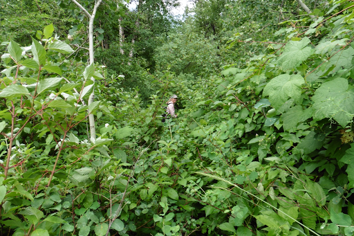
Day 3: Burn, Brush, & Beauty
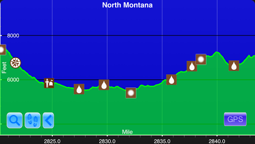
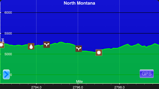
July 2nd My Lake(28mi)-Saddle 2mi N of S Fork Lick Creek(51.1) Campsite Elevation: 7,094ft 23.1mi This elevation chart is a screenshot from Guthook's CDT Hiker App. Once again, the two of us were up throughout the night with the brightness of the moon...and also the...
Day 2: The Chinese Wall
July 1stAlong W Fork Sun River(7.6)-My Lake(28mi)Campsite Elevation: 7,354ft20.4miThis elevation chart is a screenshot from Guthook's CDT Hiker App.The moon was fairly bright during the night and I kept waking up thinking it was morning. My alarm was set...
Day 1: Unfinished CDT Business
June 30thBenchmark Trailhead (0)-Along W Fork Sun River(7.6)Campsite Elevation: 5,233ft7.6miThis elevation chart is a screenshot from Guthook's CDT Hiker App.I went to bed just after 2am last night and still woke up naturally 15mins before my 7am alarm clock. I'm...
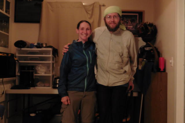
Montana Visit
After a week to resupply and rest in Portland, I made the 12hr drive to Bozeman to see my brother and his family. Many of you will recall that my brother and nephew hiked in an afternoon with me in Yellowstone on the CDT in 2013. Yes, that was the infamous bear spray...
The In Between
After leaving the Redwoods, I returned home to Portland, Oregon for a week to get my act together for the Great Divide Trail. I've never returned home mid summer like this and it was WONDERFUL! I honestly LOVE living in Portland and am soooo happy with where I return...
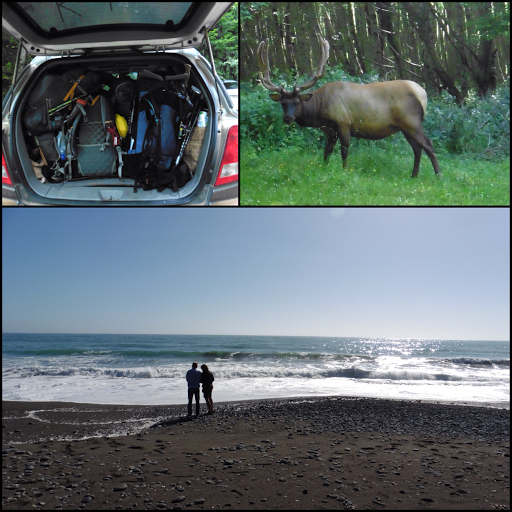
Redwoods!
I'm a bit delayed on this one, but a week ago I finished my California stage of the summer by going through the California Redwoods in Northern California. Directly, from the Lost Coast Trail, I drove north to Eureka, CA where HikeLighter.com's John Abela hosted me....
Day 3: An Overgrown Finish
June 15th Jones Beach Camp(34.1)-Usal Beach(55mi) 20.9mi We knew we had a lot of miles and elevation to do to make it to the cars today, so we got going at 6:30am. I would say three days to do this trail is ambitious, but doable for those that like big mile days...
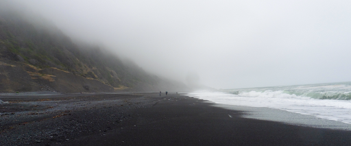
Day 2: Low Tides To High Skies
June 14th Miller Flat Campground(16.6)-Jones Beach Camp(34.1) ~17.5mi(hitched 1mi) Man, I slept hard last night! I like having a white noise to sleep and the ocean was perfect! It was calm and cool all morning. We all had some condensation, but not too much. We had...
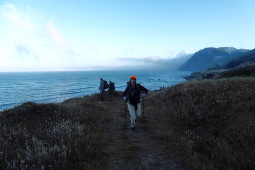
Day 1: A Reunion On The Beach
June 13th Mattole Beach(0)-Miller Flat Campground(16.6) 16.6mi Last night, the group all drove from various places to meet at Usal Beach, the southern terminus of the Lost Coast Trail. There are a lot of logistics for this short of a trail, but it's said to be...
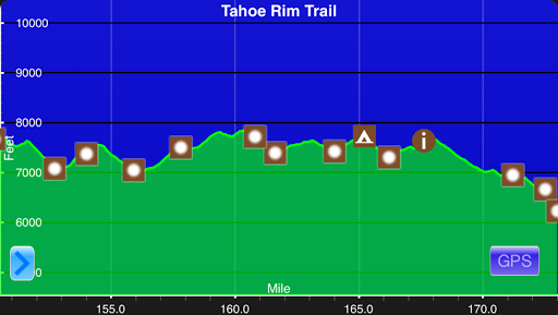
Day 9: Socked Ending
June 10th Near Luther Pass Campground(150.8)-Kingsbury South Trailhead(173.1) 22.3mi This elevation chart is a screenshot from Guthook's TRT Guide App. I can't even say when it stopped raining last night, but it rained a lot. Thankfully, it wasn't windy and it made...
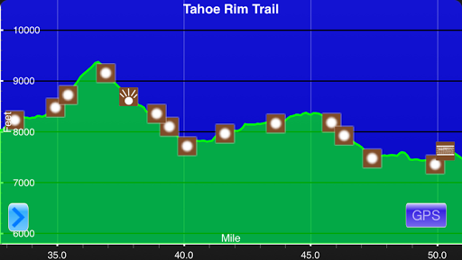
Day 8: Nice Climbs & Fun Finds
June 9th Echo Lake Chalet(132.9)-Near Luther Pass Campground(150.8) 17.9mi This elevation chart is a screenshot from Guthook's TRT Guide App. I awoke a little earlier than usual just before 5am with my routine morning call of nature. I walked down to the restroom...
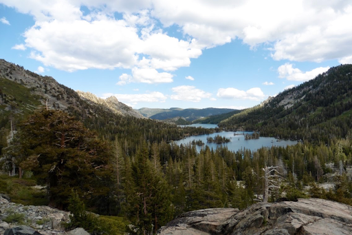
Day 7: Stupendous & Serendipitous (Part 2)
June 8th Just N of the Tahoe-Yosemite Trail Junction(114)-Echo Lake Chalet(132.9) 18.9mi Alternate Title: Lakes & Love I left off the last post with me heading down to Echo Lake to meet my friend after an AH-MAZING day of hiking and views. I wanted to split this...