
Sponsors


Day 93: Satisfying Our Hiker Hunger
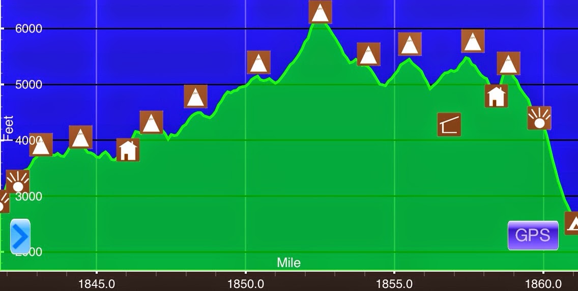
July 18thS Webster Cliff(1841.7)-Osgood Tentsite(1861.2) New Hampshire19.5miElevation chart courtesy of Guthook's AT Hiker app. He has apps for many trails including the PCT and CDT.We started hiking at 6:30am this morning knowing we had a big day ahead of us. We...
Day 92: All Is Right In Hiker World
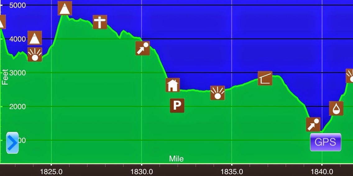
July 17thGarfield Ridge Campsite(1822.5)-(1841.7)New Hampshire19.2miElevation chart courtesy of Guthook's AT Hiker app. He has apps for many trails including the PCT and CDT.Last night, we decided to let ourselves have a relaxing morning and not leave until 7am today....
Day 91: Well Worth The Wait!
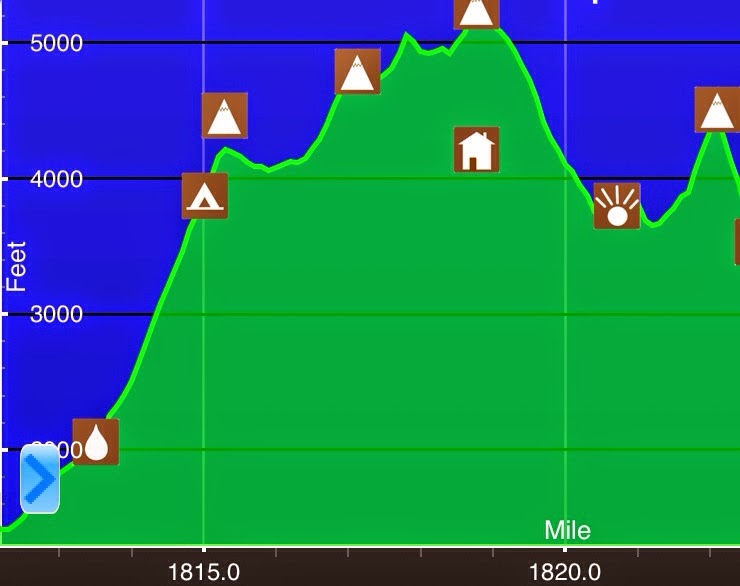
July 16th Franconia Notch/I-93(1812)-Garfield Ridge Campsite(1822.5) New Hampshire 10.5mi Elevation chart courtesy of Guthook's AT Hiker app. He has apps for many trails including the PCT and CDT. Since we are going through the Whites this leg, things are going to be...
Day 90: Yeah Buddy!
I decided to take my second zero in a row today to wait for Jett Cat. The timing for this has worked out as the thunderstorms in the Whites continued through the day today and many hikers not planning zeros chose to also wait it out. It just isn't worth going into the...

Day 89: A Zero At Swinja's
This will be a brief entry as I took my fifth zero today at Swinja's (Sweetfish & Ninja). About 75% of the day was spent burning my eyes into a computer screen as I bounced my laptop here to upload my photos from the the last ~800mi. The slideshow took much of the...
Harpers Ferry-Franconia Notch(1019.5-1812)
At the end of a section every few weeks, I like to load all the pictures and videos I've taken as a summary of that section. I did a big gap between bounce boxes again this time, so here is the slideshow of the past 792.5mi from Harpers Ferry to Franconia Notch. Many...
Day 88: A Nero To A Hiker Reunion
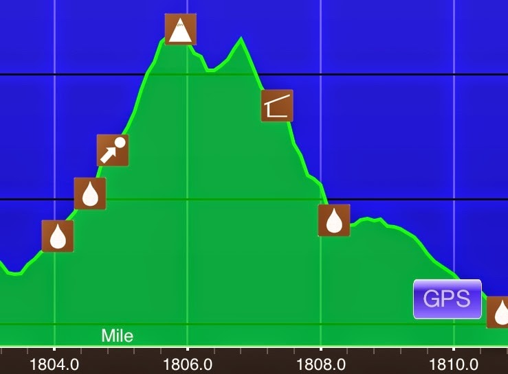
July 13th Eliza Brook Shelter(1803.4)-Franconia Notch/I-93(1812) New Hampshire 8.6mi Elevation chart courtesy of Guthook's AT Hiker app. He has apps for many trails including the PCT and CDT. I know I've only been on trail for a few days this leg, but I knew my body...
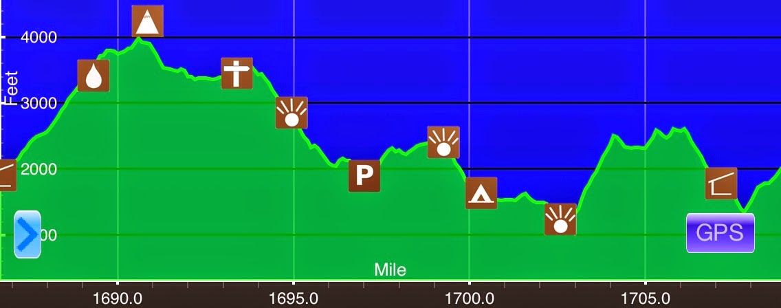
Day 87: Up For The Challenge
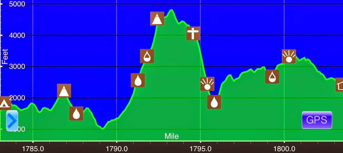
July 12th Ore Hill Campsite(1779.3)-Eliza Brook Shelter(1803.4) New Hampshire 24.1mi Elevation chart courtesy of Guthook's AT Hiker app. He has apps for many trails including the PCT and CDT. I slept really well last night and I'm really enjoying these cooler nights...
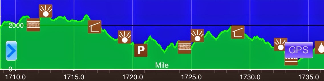
Day 86: Almost There
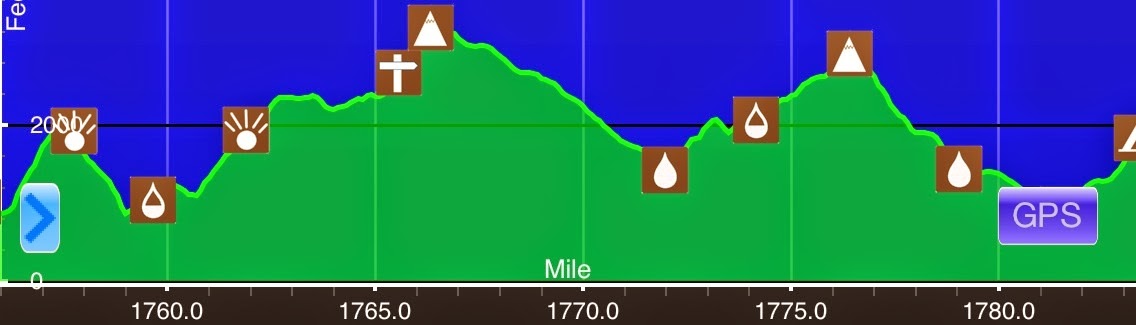
July 11thS of Goose Pond Rd(1757)-Ore Hill Campsite(1779.3) New Hampshire22.3miElevation chart courtesy of Guthook's AT Hiker app. He has apps for many trails including the PCT and CDT.I slept pretty hard last night and woke up sweating and with a sore throat. Yep,...
Day 85: The New Hampshire Reset
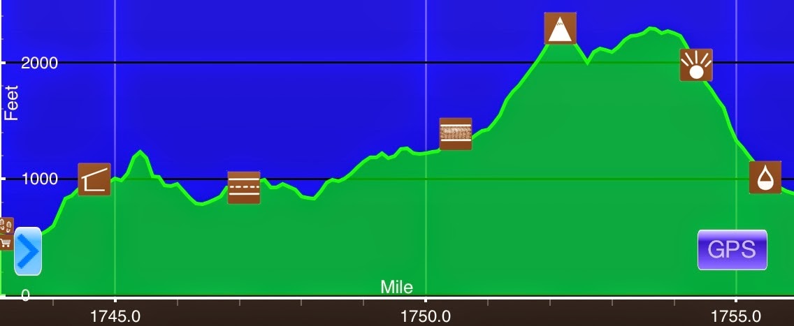
July 10th Hanover, NH(1743.9)-S of Goose Pond Rd(1757) New Hampshire 13.1mi Elevation chart courtesy of Guthook's AT Hiker app. He has apps for many trails including the PCT and CDT. I stayed up until midnight last night completing the finale of OITNB and it was well...
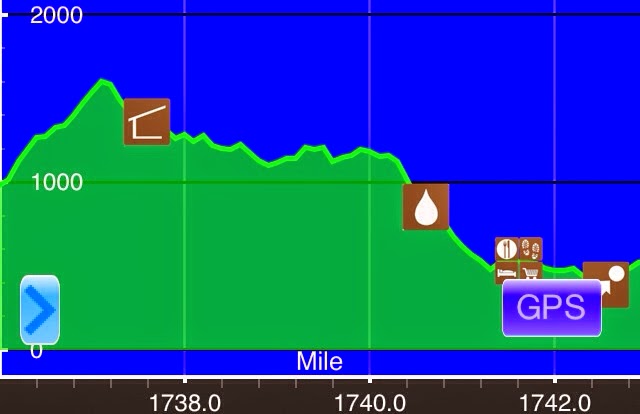
Day 84: A Nero In…NEW HAMPSHIRE Baby!
July 9th S of Happy Hill Shelter(1736.2)-Hanover, NH(1743.9) Vermont/New Hampshire 7.7mi Elevation chart courtesy of Guthook's AT Hiker app. He has apps for many trails including the PCT and CDT. It started raining around 10:30pm last night and then it thunderstormed...
Day 83: Up, Sweat, Down, Cool, Repeat
July 8th N of Stony Brook(1708.8)-S of Happy Hill Shelter(1736.2) Vermont 27.4mi Elevation chart courtesy of Guthook's AT Hiker app. He has apps for many trails including the PCT and CDT. Well, the good thing is that it didn't rain much last night. The bad news is...
Day 82: A Slippery Slope
July 7th Governor Clement Shelter(1686.4)-N of Stony Brook(1708.8) Vermont 22.4mi Elevation chart courtesy of Guthook's AT Hiker app. He has apps for many trails including the PCT and CDT. It was perfectly cool weather for lounging this morning. I was pretty tired...
Day 81: The Bad Boyfriend
July 6thGriffith Lake(1657.8)-Governor Clement Shelter(1686.4) Vermont 28.6mi + .3 reroute=28.9miElevation chart courtesy of Guthook's AT Hiker app. He has apps for many trails including the PCT and CDT.The goal for today was to try to relax a bit on the mileage and...
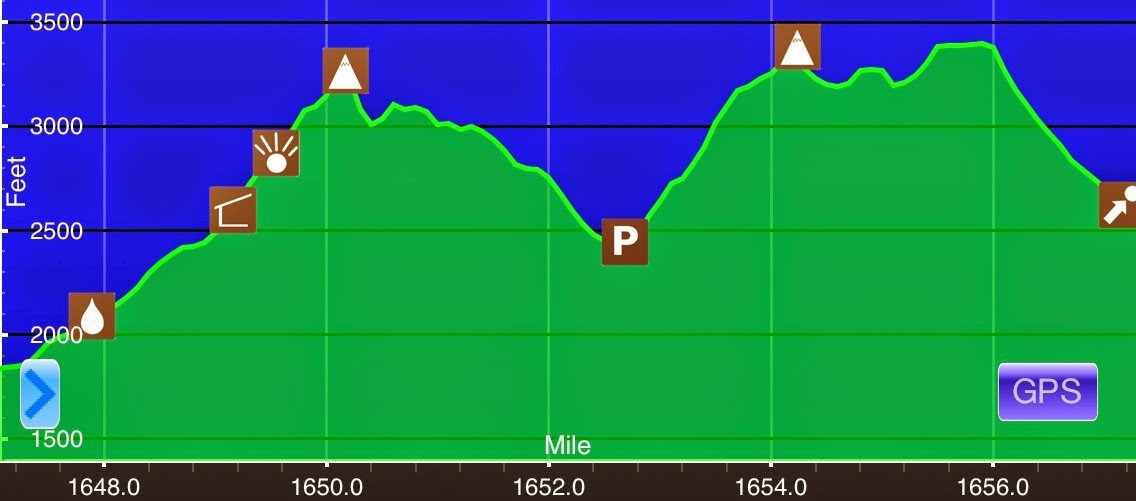
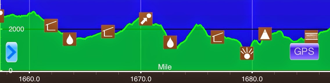
Day 80: A Much Needed Relaxing & Pleasant Day
July 5th VT 11 & 30/Manchester Center(1647.2)-Griffith Lake(1657.8) Vermont 10.6mi Elevation chart courtesy of Guthook's AT Hiker app. He has apps for many trails including the PCT and CDT. *NOTE: In these last weeks, I expect cell reception to be less frequent so...